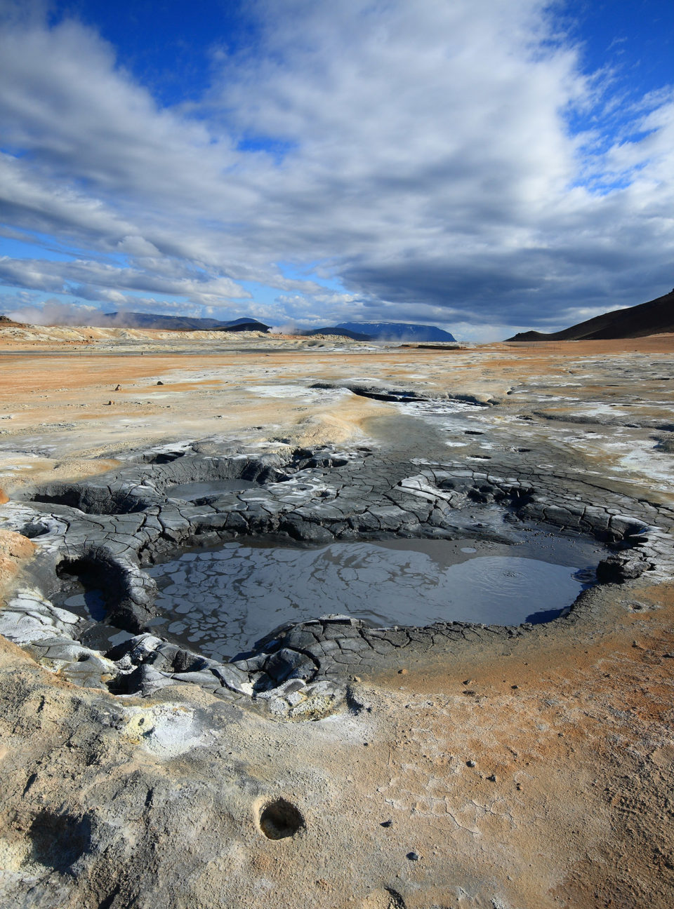
Hidden from the view, if you’re coming from Mývatn, behind Námaskarð pass the large geothermal field of Hverir is a unique wasteland in which pools of boiling mud, hot springs and hissing chimneys give life to a desolate Mars-like scenery. Not that we’ve ever been to Mars, but the metaphor gives you the idea of what is waiting for you in here.
Take your time to stroll around the bubbling gray puddles and the ethereal steam loudly pouring from the conical fumaroles. If you’ve never smelled a rotten egg this is a good chance to fill this gap. Just approach the chimneys. Not that much, you don’t want to get burned. Now open your nostrils and inhale deeply. A bit disgusting, isn’t it? But they say it’s an excellent cure against a cold. A sort of natural nebulizer.
Don’t leave without having hiked to the top of Námafjall, the mountain in the back of the geothermal field. The steep trail is naturally heated from the ground and leads to several viewpoints, some of them marked by massive rocks looking like ancient abandoned fortresses. From up here you’ll get a different and unusual point of view of one of the most impressive sight of all the Diamond Circle.
Each of the viewpoints shows a stunning view over the green and blue western landscape, with lake Mývatn, and over lava fields and striking dark mountains on the eastern side. It’s like being on the border between two different worlds in the distance, having a third one, a red and brownish steamy world, all around and below you.
Getting There
If you’re coming from Reykjahlíð, on lake Mývatn, follow road n.1 for 6km direction East and you’ll find the junction, on the right side of the street, with the short road leading to the parking area of Hverir.
If you’re coming from Dettifoss, reach road n.1 and drive in the direction of Akureyri to the west. You will see the geothermal area and the parking lot before the hill on the left hand side.
GPS: 65°38’27.8″N 16°48’33.3″W