One of the most forgotten regions of Iceland, probably the most forgotten overall, the farther north-east one has at its tip the “Arctic Fox plain”, Melrakkaslétta. Apart from the lonely Grimsey and the even more lonely Kolbeinsey, this peninsula has the northernmost strip of land of the country. Melrakkaslétta is no land of ice and fire and has no natural marvels. You would hardly hear anything else than birds screeching and wind whistling. A charming and striking atmosphere of abandonment lingers everywhere.
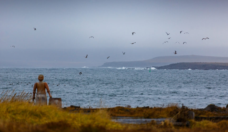
The tiny village of Kópasker on Öxarfjörður is the western gateway of Melrakkaslétta. Here the Earthquake Center show installations on seismic activities around the world and focus on Icelandic tectonic activity in the ’70s and ’80s (a big earthquake out of the coasts of the peninsula and a volcanic eruption in Mývatn area happened in that period). Left Kópasker behind, solitude and pristine nature uncontested prevail. Beaches full of driftwood, lakes and ponds, moors, basaltic black stacks and cliffs is what awaits you here, together with a rich fauna among which an impressively high number of birds rule the roost. Common Redpoll, Redwing, Great Skua, Gulls, Red-throated Diver, Ringed Plover, Dunlin, Ruddy Turnstone, Red Knot, Razorbill, Northern Gannet and Great Cormorant are the most common species to spot. But the most wanted usually is the elegant Gyrfalcon.
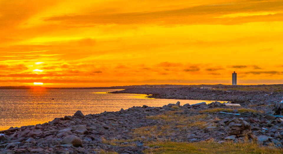
In northwestern Melrakkaslétta is the isolated cape of Rauðinúpur, a red shade ice age volcano, which stretches into the sea with a peculiar shape that makes it a unique landmark and from where an end-of-the-worldly scenery is revealed to the braves who venture there. On the way to the extremity of the peninsula several other bird-watching places follow one another until all the north-eastern corner of Melrakkaslétta. The two promontories of Rifstangi and Hraunhafnartangi compete to be the northernmost spot of the mainland. The first one probably wins the title by a couple of centimeters but the second one has a lighthouse at its end which tickles the Arctic Circle less than 3km away. An amazing destination to experience a truly dramatic moment with a view on the open, endless sea and nothing else.
Not far from the lighthouse, only a few kilometers South, stands Raufarhöfn, the northernmost village of Iceland. On the mainland at least. This kind of spectral place, with its bunch of colored houses slightly bleached out, is somehow magnetically attractive. Here the impressive Arctic Henge, a stone monument for Pagan worshipers inspired by Stonehenge. South from Raufarhöfn, at the end of Melrakkaslétta, is located Rauðanes, a small cape which offers the best short hike in all the area. Bizarre rock formations, natural arches, stacks, caves and secluded beaches are the highlights of the circle path around this scenic headland where the steep cliffs are full of nesting birds.
Getting There
Melrakkaslétta is the entire area between road 870 in the north and road 85 in the south. It is about an hour drive away from Húsavík.