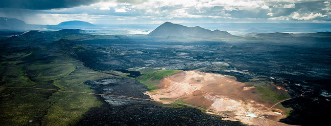
The Krafla Caldera is a 10km long, 2km deep, cauldron-like geological feature perched on the edge of the Eurasian and American tectonic plates. A collapsed, but still active volcanic area, in total there’s been 29 recorded eruptions, the most recent of which was the Krafla Fires in the 1970s.
For tourists, there are three main highlights to the Krafla area. Leirbotn (the geothermal power station), Víti Maar (a volcanic crater with an opaque, teal green lake) and Leirhnjúkur (steaming sulfuric terrain and multicolored lava field landscapes).
A survey undertaken in 2006 found magma only 2,1km deep. The earth’s crust is very thin in this area what leads to several natural phenomena. The heat is utilized at Krafla power station.
Here is more scientific information and a geothermal map of the area.
Krafla Power Station
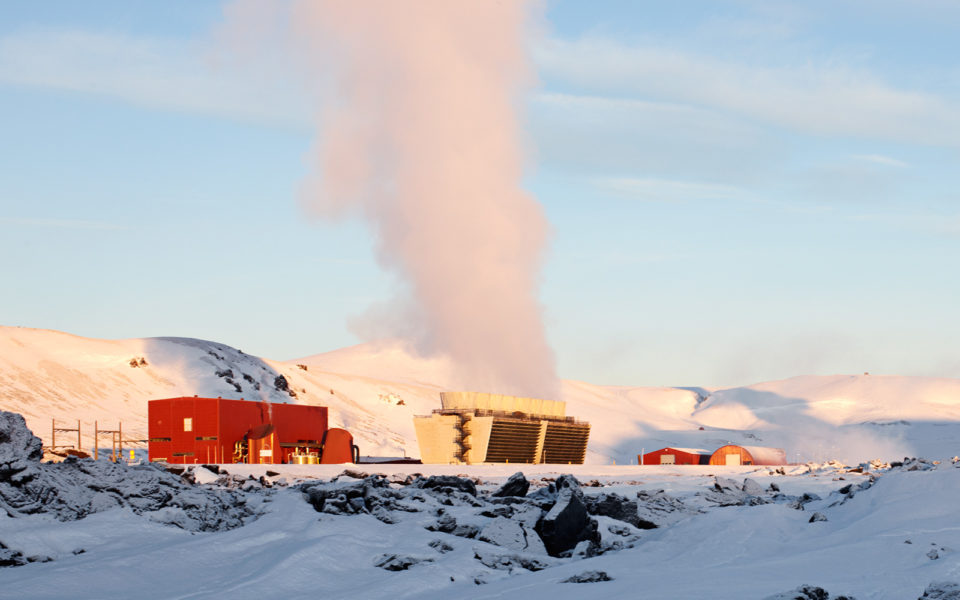
Vivid blue hot streams, bizarre sci-fi architecture and the photogenic plumes of the geothermal power station make the approach to Krafla almost as exotic as the volcanoes themselves. The 2000 meter deep boreholes here supply geothermal energy for most of the surrounding region, pumping it out through enormous pipes which form a sort of gateway over the road.
Many people stop and take a photograph or two here, but most don’t realize there´s a visitor center too, where you can step inside for a closer look. If interested in this, make sure you time it right, as it’s only open on summer.
The construction of the power plant started in 1974 with trial boreholes. Short after the whole plan was threatened by seismic and volcanic activity. The Krafla fires, how the series of eruptions was later called, happened less than 2km away from the construction site. The power station started operating in 1978 and reached its full potential on 1984 after a strong decline of the volcanic activity.
Víti Crater
Víti Maar, the name translates as crater of hell, is a volcanic crater formed in 1724 by an eruption of steam. Its opaque teal green lake and easily accessible road create one of the photographic hot spots on the circuit around Lake Mývatn. For those wishing to take a walk, there is a 30 minute trail around the edge, which leads on to a hot spring. Take care with children or if it’s a rainy day, the slopes are steep and the path can be slippy. Looking East you can see the small mountain, 818mt high, after which all the area is named, Krafla. Looking West you might be able to have a glimpse over one of the most surreal landscapes you’ll ever see. Climb down and walk the short distance to Leirhnjúkur lava fields.
There is another crater called Víti in Iceland and that is the one next to Askja caldera.
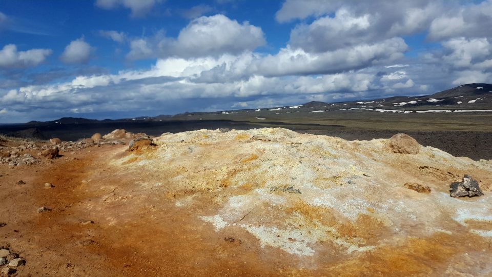
Leirhnjúkur Lava Fields
What you can see here are the remnants of the last eruption dating 1975 to 1984. Don’t make the common mistake of taking few pictures of the boiling mud pots and heading back. Give yourself time to explore all the primordial magnificence of the multi color painted fields where magma.
With steaming sulfuric terrain and craggy, lava field landscapes, this is truly one of the must-see gems of the Mývatn area. You can walk 20 minutes to get to the edge of the area, or if you have time, it’s an unforgettable experience to spend an hour or two traversing the rest of the field. At several placed the lava is still warm and releasing boiling hot steam into the air. A full spectrum of colors inhabit the magma, with the greens of moss and lichen next to the scorched earth colors of sulfur and rhyolite. With weird textural formations, expansive views across the caldera and less tourists than other nearby Mývatn highlights, this is a magical, magnificent chance to walk within an active volcanic area.
Just watch out not to step on the pale colored clay, it might well melt the soles of your shoes. For those looking for a bigger trek, there is also a 3-4 hour walk from the information center at Reykjahlið to Leirhnjúkur and back.
Getting There
Take the east road from Lake Mývatn, towards Egilsstaðir. As you leave the lake and pass over Mount Námafjall, turn left, away from the bubbling mud pools and sulfuric landscape of Hverir, up road 863 towards Krafla. The road passes beneath the geothermal pipes of Leirbotn, swinging up and around, past the car park for Leirhnjukur, to the impressive viewpoint across Víti crater.
Please note that the road, especially the last part after the Krafla geothermal power station, may be impassable in winter time due to heavy loads of snow. Check the road conditions at road.is before heading there.
GPS: 65°43’02.8″N 16°45’16.2″W