The Öxafjörður fjord spans about 30km between Tjörnes peninsula and Melrakkaslétta. In the past millenia the Jökulsá river has brought a lot of sand and sediments into the fjord, creating a flat sandy area. Once the coastline was where Ásbyrgi canyon is today and moved all the way north to where it is now. In total it shaped an area of 300 km² called Austursandur, or East-Sand, at the eastern sand of the river and Vestursandur, or Vest-Sand, on the west side of the river. Til today the river is changing its course and direction. That is why there are strict rules on where people are allowed to live and erect buildings. This is done to minimize the danger of a changing river bed or a glacial flood, due to volcanic activity. The bridge one crosses north of Ásbyrgi has been constructed in such a special way that it can be removed and stored in a safe distance in case a glacial flood is threatening the area.
Many ponds and rivers can be found int he sandy channels. The largest lakes are called Víkingarvatn, which translates as Viking lake, and Skjálftavatn or Earthquake lake. The lake was formed in a series of large earthquakes in 1976. The Earthquakes became known as the Kópasker earthquakes because they caused considerable destruction in the area. Today the Skjálftasetur Earthquake Center informs about them.
The entire area has a very interesting geology because the north Atlantic ridge passes through the fjord from the south to the north, also known as Tjörnesbeltið. Here the tectonic plates are moving apart, causing a lot of earthquakes. However, most of the earthquakes happen out at sea or are too weak to me noticed by humans.
Hiking Trails
The most prominent hiking site is of course Ásbyrgi canyon with many hiking trails in and around the canyon.
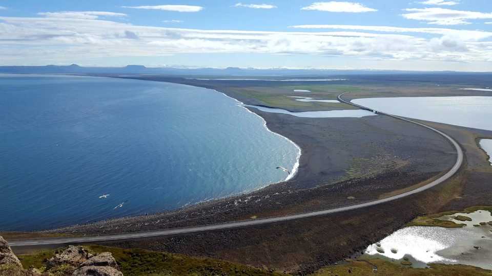
Coming from Húsavík, there is a viewing platform on a cliff. It is at the last turn of Tjörnes peninsula on the left hand side before driving down into the Öxafjörður fjord. Many birds can bee seen from the platform, among others puffins. A hiking trail leads up the mountain at the opposite side of the street, which offers a magnificent view over the entire fjord.
Getting There
Öxafjörður fjord is about 40km north of Húsavík, following road 85.