The northeast of Iceland is also known as the Edge of the Arctic. It includes the northernmost strip of land of the country. The lowlands of Melrakkaslétta are no land of ice and fire and has no natural marvels. One would hardly hear anything else than birds screeching and wind whistling. A charming and striking atmosphere of abandonment lingers everywhere. Here one can experience total loneliness in nature, silence with nothing around but natural sounds and no signs of human interference.
If you are looking for original nature and want to calm down from the daily hustle and bustle, reset your senses and take a break from civilization, this is the tour for you. This tour is also highly recommended for bird enthusiasts because the northeast of Iceland is known for its variety of species.
The total length of the tour is ca. 330km starting and returning from Húsavík. The tour is suitable for any type of car during the summer month, but may be partially closed in winter time. In winter a 4×4 cars i recommended. Check the current road conditions at road.is before taking off. See the opening hours of all places here.
Highlights of the Day
- Tjörnes Peninsula
- Mánarbakki Turf House
- Hringsbjarg observation point with view over Öxafjörður Fjord and possibility to see puffins
- Ásbyrgi Canyon
- Rauðanes Rock Formation
- Raufarhöfn Village
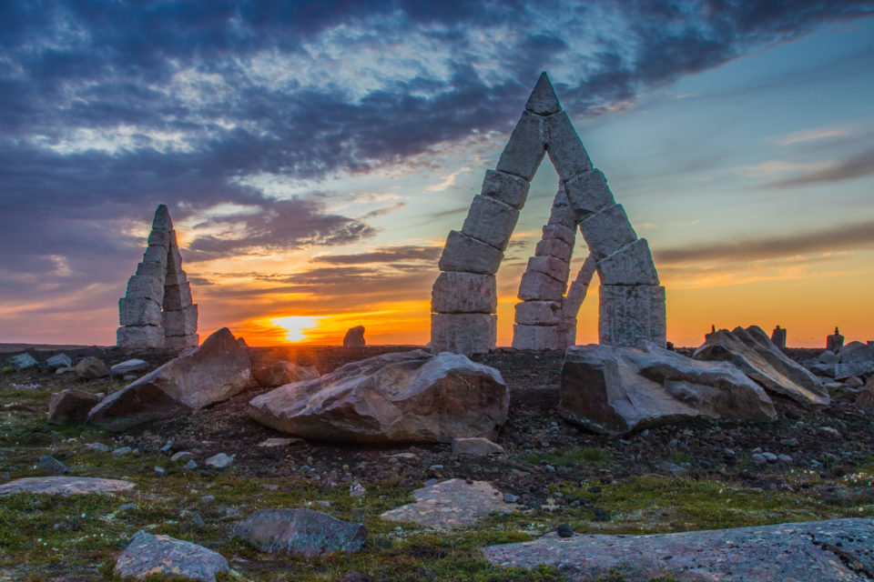
- Arctic Henge
- Melrakkaslétta plain with Hraunhafnartangi Light House
- Kópasker Village
- Skjálfatssetur Earthquake Information Center
- Sauðaneshús Folk Museum
Route
- Leave Húsavík heading north on road 85 around Tjörnes peninsula. After about 23km Mánarbakki turf museum can be seen on the left hand side.
- Continue on road 85 for about 12km until you see the viewing platform Hringsbjarg on the left hand side. Here one can enjoy the view over Öxafjörður Fjord, observe many seabirds breeding at the cliff and see puffins.
- Continue 27km on road 85 until you reach Ábyrgi canyon. Stop at the Gljúfrastofa Visitor’s Centre to learn about the canyon and take a hike around the area.
- From Ásbyrgi road 85 continues for about 30km straight north, at the junction take a right turn in the direction of Raufarhöfn and Þórshöfn. Continue for another 30km, take another turn to the right heading to Þórshöfn at the next junction, continue on road 85 for 7km until you reach the farm Vellir. There is a parking lot and a map showing the 7km long hike until Rauðanes Rock Formation.
- Return to road 85 and drive the same way back that you came for about 7km until you reach the junction. Now take the right run heading to Raufarhöfn at road 85. Take a stroll around Raufarhöfn village and up to the Arctic Henge.
- Leave Raufarhöfn heading north on road 870. Drive 11km until you see Hraunhafnartangi light house. Leave the car at the parking lot and walk the last few hundred meters. It is not possible to drive all the way.
- Continue on road 870 for about 43km until you reach the village Kópasker. Take a stroll in Kópasker and make sure to visit the Earthquake Center.
- Leave Kópasker on road 870 heading south. Sauðanes Folk Museum is right next to the church about 2km south of town.
- Follow the road signs to return to Húsavík on road 85.