From Grjótagjá is already visible the broad dark silhouette of Hverfell, not far from the eastern shore of lake Mývatn. Both spelling, Hverfjall or Hverfell, are correct and can be used.
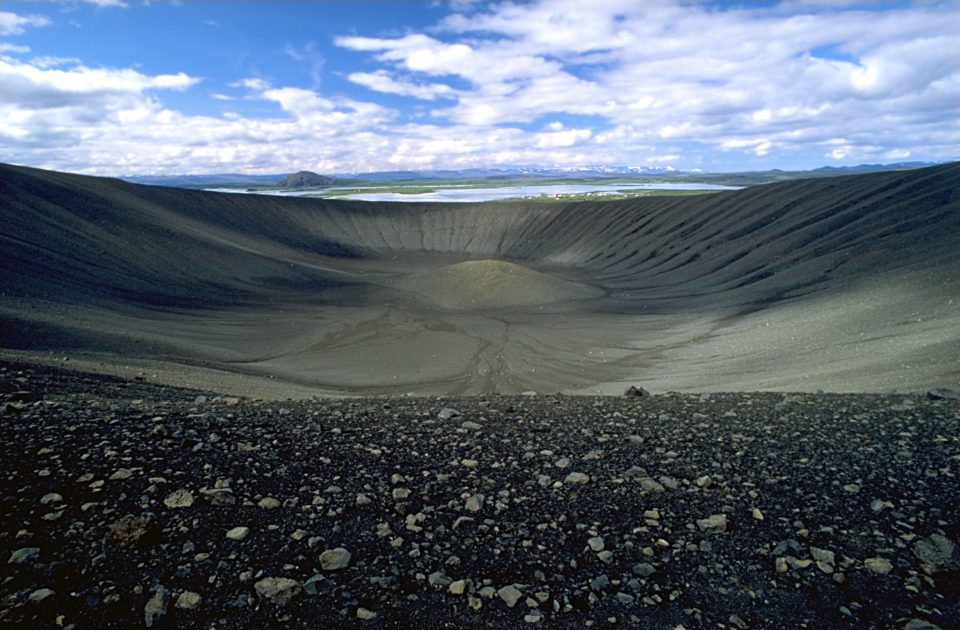
The 2700 year old crater is almost perfectly circular and its top is reachable from the parking. The uphill path is steep but easy and short, it takes only 10-15 minutes to get to the summit. Up here the breathtaking panorama stretches from the reddish and dark hills half covered in moss in the East, dotted with steam rising from the ground here and there, to the sparkling lake surrounded by lush green vegetation. Moreover the view of the huge crater itself is stunning and the walk on its rim gives different angles of the scenery which is of course the same but that seems to mutate step after step.
The rim of the crater is only accessible by two paths, from the northwest and south. It is strictly forbidden to use other routes in ascent or descent.
Geology
Hverfjall is a tephra cone or tuff ring volcano to the east of Mývatn.
It erupted in 2500 BP in the southern part of the Krafla fissure swarm. The crater is approximately 1 km in diameter and 140m deep. Tephra has been carried from Hverfjall all over the Lake Myvatn area. A landslide apparently occurred in the south part of the crater during the eruption, which accounts for the disruption to the round shape of the mountain. During the Age of Settlement, lava flowed from Svortuborgir, at the southern end of Namafjall, around Hverfjall, which was nearly engulfed by the lava. At the same time an eruption occurred in the slopes above the valley of Hliðardalur.
Getting There
To get to Hverfjall drive 3,5km from Reykjahlíð, direction South, on road nr 848. A sign at a junction to the left points the way to the crater. The parking is 2,5km away on a gravel road.
GPS: 65°36’34.4″N 16°52’18.9″W