This tour trails along the highlights of Mývatn area, orbiting around the lake from west to east: the soft landscape of Skútustaðar pseudocraters, the lava columns at Höfði peninsula, the mystical lava formations of Dimmuborgir and Hverfjall mountain. Of course the tour also includes the famous caves of Stóragjá and Grótagjá– the highlight for every Game of Thrones fan. A stopover at Krafla Caldera and the Hverir geothermal area show how active the earth still is these days. The day ends with an educational tour through Sigurgeir’s Bird Museum with its impressive collection of Icelandic birds. The return road leads through an rock desert that turns into a purple cloud in summer time because of the lupine.
The total length of the tour is 175 km and it is suitable for all cars. In wintertime road 87 to return to Húsavík may be impassable because it has limited service in winter. Check the road conditions at road.is. All opening hours can be found here.
Highlights of the Day
- Skútustaðargígar pseudocraters
- Höfði peninsula
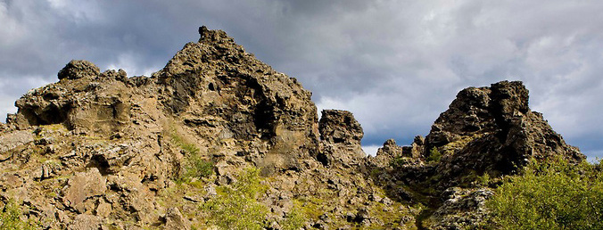
- Dimmuborgir Lava Formations
- Hverfjall Mountain
- Grjótagjá and Stóragjá Cave
- Krafla Caldera and Lava Fields
- Hverir Geothermal Area
- Sigurgeir’s Bird Museum
- Hólasandur black desert
Route
- Leave Húsavík heading south on road 85. After ca. 20km road 85 takes a turn to the right, stay straight on road 845. Continue for 6,7km, turn left at the junction to road 854, direction Laxávirkjun. 4km later you have reached Grenjaðarstaður turf farm house on the left hand side next to the church.
- Return to road 845. Stay straight at the next junction and follow the signs to Mývatn. Continue on road 1 for 22km and stay straight at the next junction, changing to road 848. 5km later you have reached the parking lot of Skútustaðargígar pseudocrater next to Sel Hótel. Several trails lead around the area.
- Continue on road 848 for 7km, the parking lot of Höfði peninsula is on the left side. The parking lot is the starting point for several walkways.
- Continue on road 848 for 2km, follow the road signs to Dimmuborgir until you have reached the parking lot. There is a public restroom, souvenir shop and café. Many hiking trails guide around the area.
- Once more continue on road 848 for 1,5km and follow the signs to Hverfjall mountain. Depending on the time of the year this track may not be suitable for all cars. A walkway leads up to the crater.
- Return to road 848 for 2km, then take a turn to the right to Grjótagjá. Follow this road 860 for 2,3km until you see the parking lot of Grjótagjá at the left hand side.
- Continue on the same road 860 until you have reached the national road 1, take a turn to the right in the direction of Egilsstaðir, drive over the hill and stop at the parking lot on the right side to explore Hverir geothermal area.
- Continue on road 1 for a few hundred meters until the next junction and follow the signs leading to Krafla power station. Drive through the power plant area with a short stop at the information center, up the hill and explore the area around Krafla Caldera. The last section of this road can be impassable in winter time.
- Return to road nr 1 and drive back in the direction of Mývatn until you have reached the junction between road 1 and road 848. Drive left to Reykjahlíð village. At the junction take a turn to the right heading in the direction of Húsavík or road 1. Here are a gas station, supermarket and several restaurants. Park the car around the supermarket and take the trail back to the junction, cross the street and follow the signs to Stóragjá cave.
- Continue on road 1 heading to Húsavík, follow the road at the next junction and take a turn left. 1,3km you will see the sign pointing to Sigurgeir’s Bird Museum on the left side.
- Return to road 1 and drive back the same road that you came but this time take a turn to the left at the junction in the direction of Húsavík or road 87. Soon you will cross the Hólasandur rock desert on your way back to Húsavík.