The northeast of Iceland has a lot to offer and the most beautiful sights are easily reachable from Húsavík. Some of them are well known by know, some are still hidden gems. The Vatnakökull National park and UNESCO world heritage as well Mývatn area is just around the corner.
Below is a list with the most amazing landmarks. Here you can find suggestions for hiking trails and day trips to make sure you see the most during your tip.
Aldeyjarfoss Waterfall
Aldeyjarfoss is one of most impressive waterfalls on the Skjálfandafljót River’s route from the Vatnajökull ice cap to Skjálfandi Bay. Read more>
Akureyri
Even if not a real megalopolis, Akureyri, the Capital of North Iceland, with a population of 18.000, is a sparkle of civilization in the mostly wild northern belt of the island. Read more>
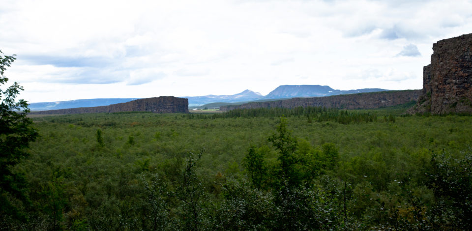
Ásbyrgi Canyon
A gigantic, anomalous, horseshoe-shaped rock formation, Ásbyrgi stands guard next to the northern entrance to the 35km Jokulsá Canyon. Read more>
Bakkahöfði and Gatanöf Rock Fomartion
Just about 3km north of Húsavík is a small peninsula with beautiful rock formations that form the perfect background for sunset and northern lights photography. Read more>
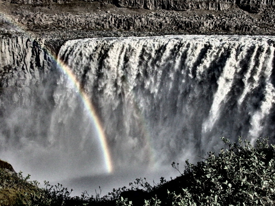
Dettifoss Waterfall
This monstrous behemoth of a waterfall is guaranteed to steal your breath away. Set within stark, rocky surrounds with bone-shatteringly heer drops on either side, there couldn´t be a more fitting backdrop for such untethered natural power. It’s a truly unmissable jewel in the Diamond Circle’s crown, one you will never forget. Read more>
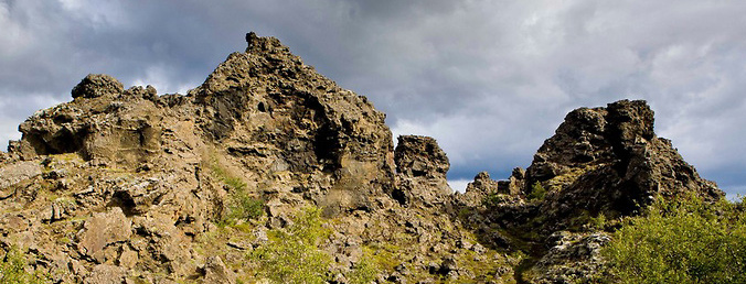
Dimmuborgir Lava Formations
Twisted towers of coagulated rock breach the earth’s surface to form a lava field full of giant pillars, chimneys and tubes to scramble across. These dramatic structures never fail to impress and are one of Iceland’s most popular tourist destinations. Read more>
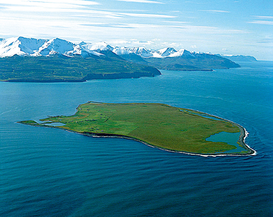
Flatey Island
Flatey is an abandoned island settlement on the edge of Skjálfandi Bay. Spread flat, this veritable pancake of a land mass is rich in bird fauna, with over 30 different types of bird to watch. Read more>
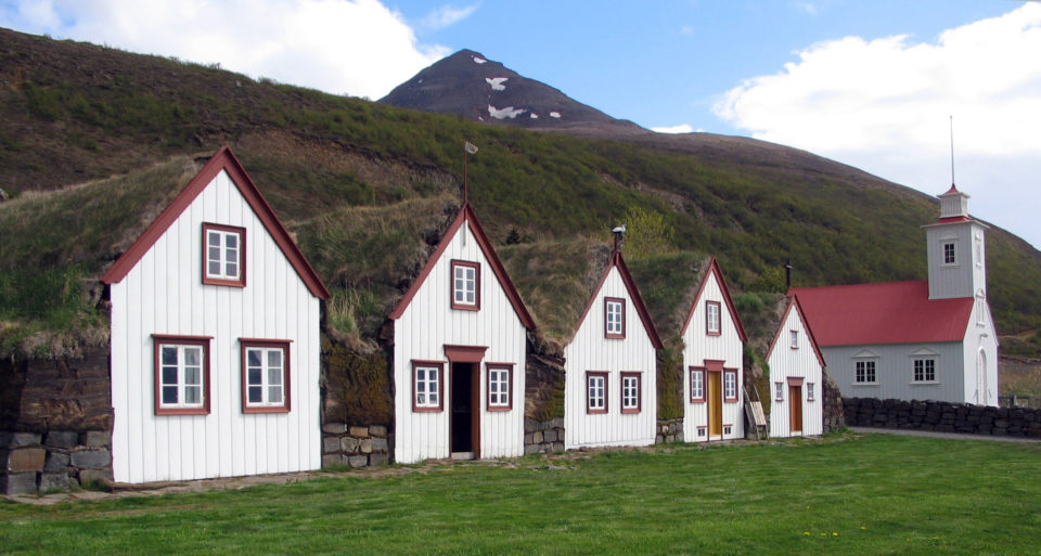
Flateyjarskagi Peninsula
With lush canyons, bubbling brooks, and mountains tucking glacial deposits in their wake, Flateyjarskagi peninsula is the perfect place to hike. Evidence of how Icelanders lived in days gone by can be found at Laufás, a 19th century vicarage. Read more>
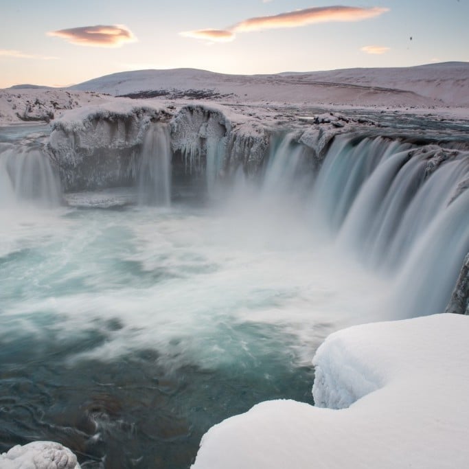
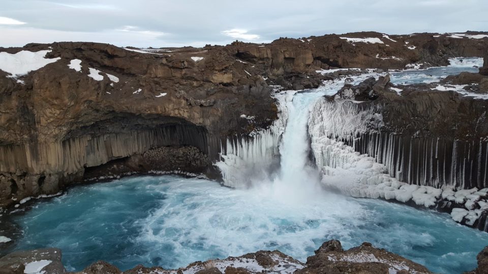
Goðafoss Waterfall
The waterfall of the gods is at the outermost western corner of the Diamond Circle, at its boundaries, but Goðafoss’ gorgeousness makes of this place the umpteenth wonderful spot to discover in your trip along this region. Moreover the waterfall is connected with one of the most important events in Icelandic history: the conversion to Christianity in 1000. Read more>
Grimsey Island
Some dozens of toughened fishermen, millions of seabirds, rocks, cliffs, grass, sea and wind. This is what awaits you in Grimsey, the only piece of Iceland which is crossed by the Arctic Circle. 40km from the mainland, this island of 5,3 square kilometers has one single settlement, Sandvík, placed on the southwestern shores. Read more>
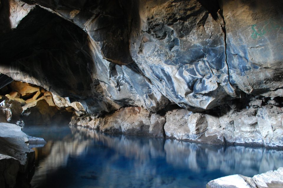
Grjótagjá & Stóragjá Caves
There are two caves close to Reykjahlíð. The water that fills the caves is brightly blue and utterly clear, the air inside is warmed up by the heat of the water and the whole setting is otherworldly. Read more>
Hafragilsfoss Waterfall
Just a bit downstream of Europe’s most powerful waterfall, Dettifoss, is another beautiful waterfall, the Hafragilsfoss. The name could be loosely translated as Goat canyon waterfall. here the water drops about 27m into Jökulsárgkjúfur canyon and is part of the surreal environment of Rauðhólar. Read more>
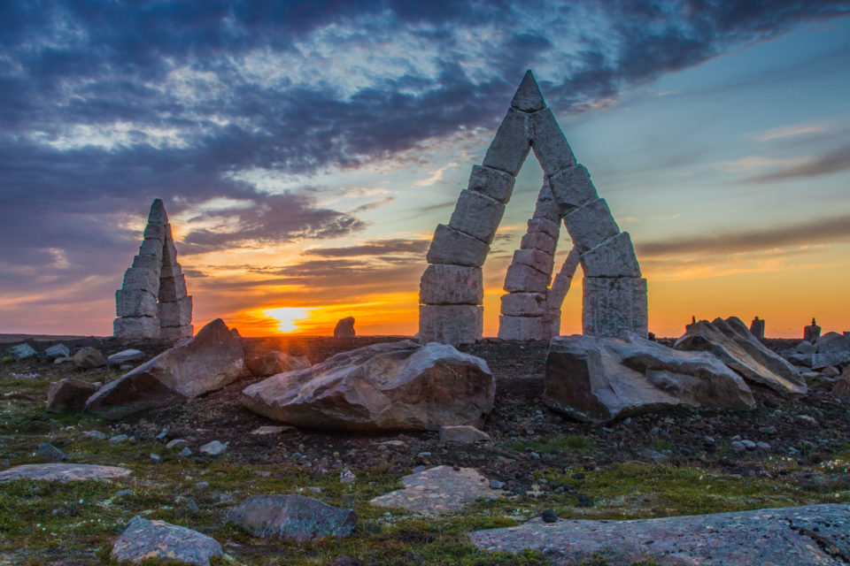
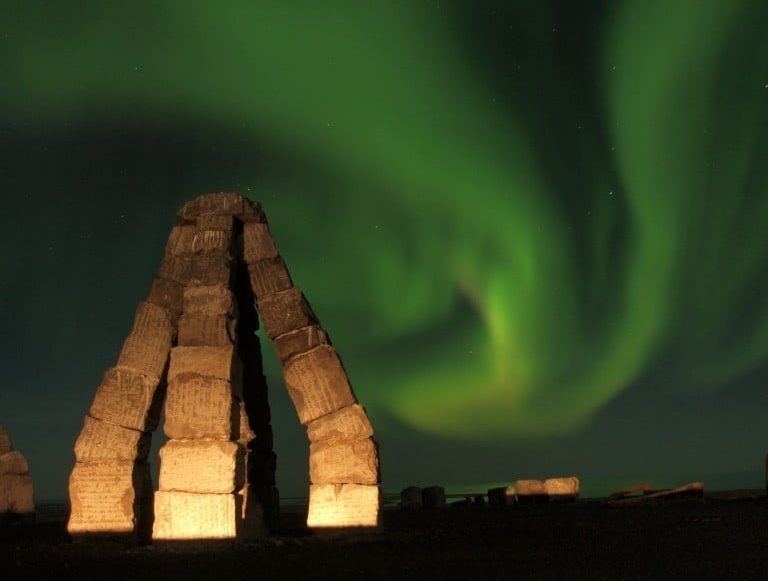
Heimskautsgerðið Arctic Henge
The Arctic Henge is a newly built monument for the island´s Pagan worshippers, the Ásatrú. Similar to its ancient predecessor, Stonehenge, the Arctic Henge is like a huge sundial, aiming to capture the sun´s rays, cast shadows in precise locations and capture the light between aligned gateways. Read more>
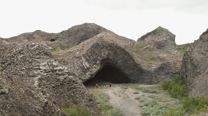
Hljóðaklettar and Vesturdalur Rock Formation
Along the magnificent valley of Vesturdalur the highlights you must not miss are the bizarre basalt rocks at Hljóðaklettar. A series of vertical, horizontal and diagonal columns, formed by mysterious volcanic activity, standing over the ground and modeling rosettes, swirls, spirals and honeycombs. There is also a campsite. Read more>
Holasandur Rock Desert
Hólasandur is an uninhabited large area along road 87 between Mývatn and Húsavík that consists mainly of a black sand desert. The area is also a great spot to observe North lights in winter because of the total darkness all around. Read more>
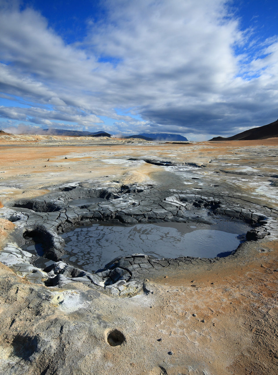
Hverir Geothermal Area (Námaskarð)
The large geothermal field of Hverir is a unique wasteland in which pools of boiling mud, hot springs and hissing chimneys give life to a desolate Mars-like scenery. Read more>
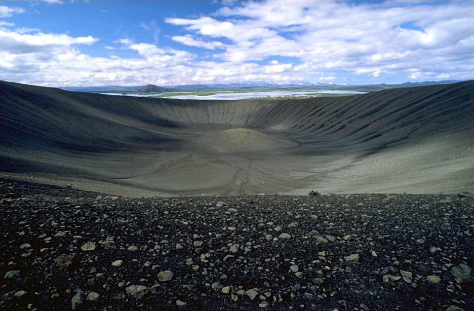
Hverfjall/ Hverfell Mountain
Hverfjall is a tephra cone or tuff ring volcano to the east of Mývatn. It erupted in 2500 BP in the southern part of the Krafla fissure swarm. The crater is approximately 1 km in diameter and 140m deep. Read more>
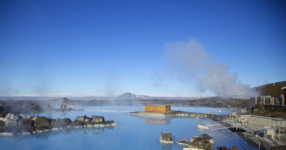
Jarðböðin Mývatn Nature Baths
A short distance uphill from Lake Myvatn is the North´s version of the Blue Lagoon: Mývatn Nature Baths. A great place to soothe your aching limbs after hiking around the lava fields, the baths here are easily one of Iceland´s finest geothermal pools. Read more>
Kópasker Village
The name of Kópasker could be translated as seal pup skerry. The village has 130 inhabitants and all the service that is needed. Several museums and exhibitions await guests. Read more>
Langanes Peninsula
Competing with Melrakkaslétta for the record, the eastern region of the farthest northeastern corner of Iceland is another truly out-of-the-way place. The moorlands are cushioned in moss and riddled with lakes and marshes. A paradise for ornithologists. Read more>

Lundey Island
Just 4,5 nautical miles north of Húsavík is a small island called Lundey, what translates as Puffin Island. Even though Puffin Island reaches 34m above sea and is only about 200 m long and 100 m wide it becomes home for 200,000 puffins during the breeding season. Read more>
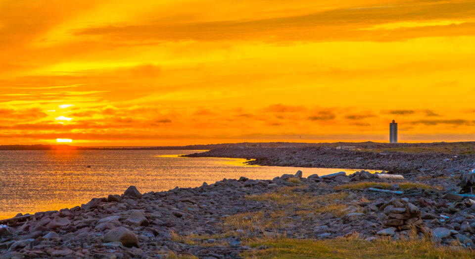
Melrakkaslétta Peninsula
The two promontories of Rifstangi and Hraunhafnartangi compete to be the northernmost spot of the mainland. The first one probably wins the title by a couple of centimeters but the second one has a lighthouse at its end which tickles the Arctic Circle less than 3km away. An amazing destination to experience a truly dramatic moment with a view on the open, endless sea and nothing else. Read more>
Northern Lights (Aurora Borealis)
Aurora Borealis is a natural light phenomenon caused by magnetic particles from the solar wind interacting with the Earth´s atmosphere. The northeast of Iceland has the perfect conditions to see them. Read more>
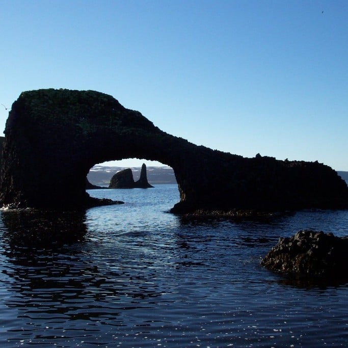
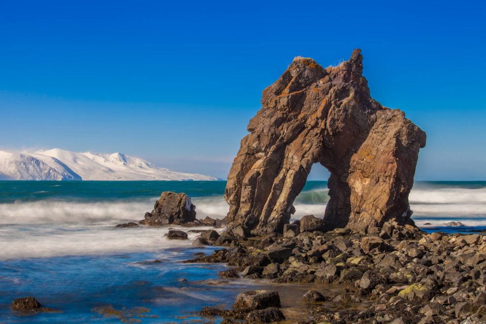
Rauðanes Rock Formation
Rauðanes is a series of unusual rock formations on the tip of a beautiful inlet, west of Þistilfjörður. A special slice of coastline, featuring collapsed caves, volcanic arches and varied birdlife, this is well and truly off the beaten track. Read more>
Raufarhöfn Town
Raufarhöfn is the northernmost community in Iceland with 250 inhabitants. The arctic circle is only a few kilometers far away and the Arctic Henge is the landmark of the town. Read more>

Selfoss Waterfall
Selfoss is the little sister of Europe’s most powerful waterfall Dettifoss. Often overlooked because of it’s powerful neighbour, this waterfall impresses with its many streams forming one wide curtain of waterfall. Read more>
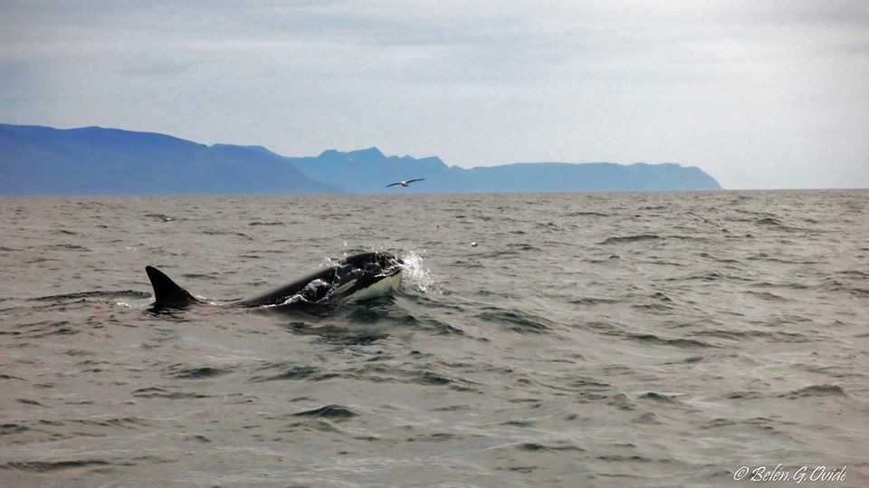
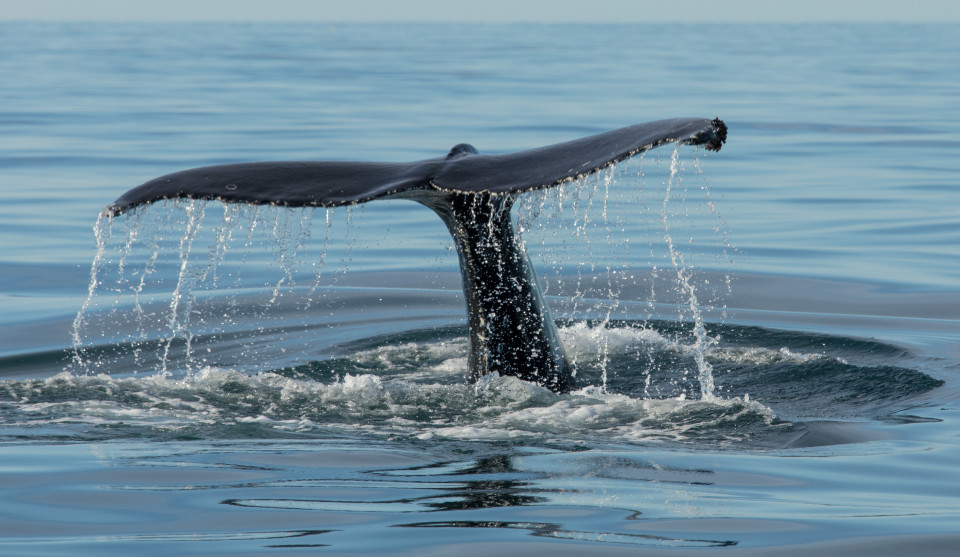
Skjálfandi Flói Shaky Bay
A hive of cetacean activity, Shaky Bay, together with its harbour town of Húsavík, is often regarded as one of the best whale-watching places in Europe, with the local boat companies offering practically guaranteed sightings over the summer months. Read more>
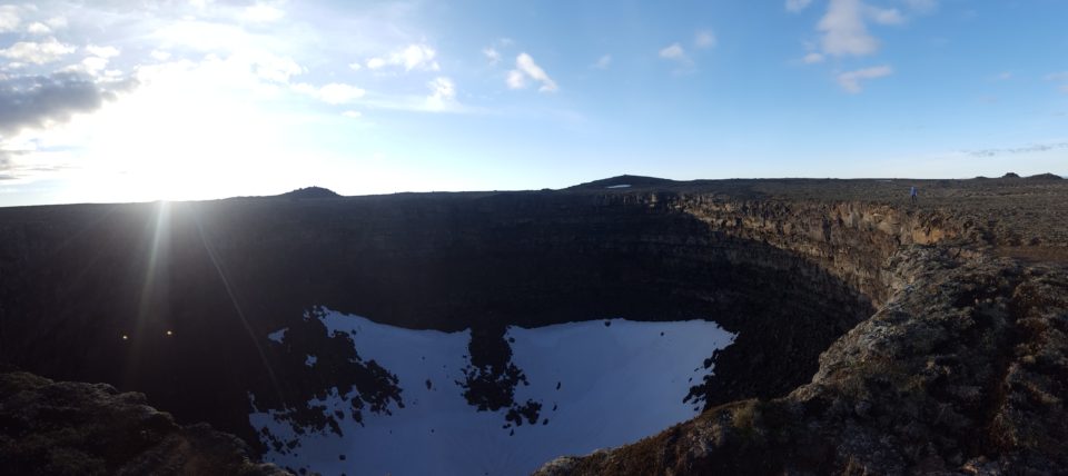
Stóra Víti & Litla Víti
The Þeistareykjarbunga is one of the largest shield volcanoes in Iceland that was formed about 10.000 years ago. Its highest point is 564m above sea-level and well visible. The main crater is the Stóravíti crater. The circular crater has a diameter of 800-1.000m and is about 100m deep. Read more>
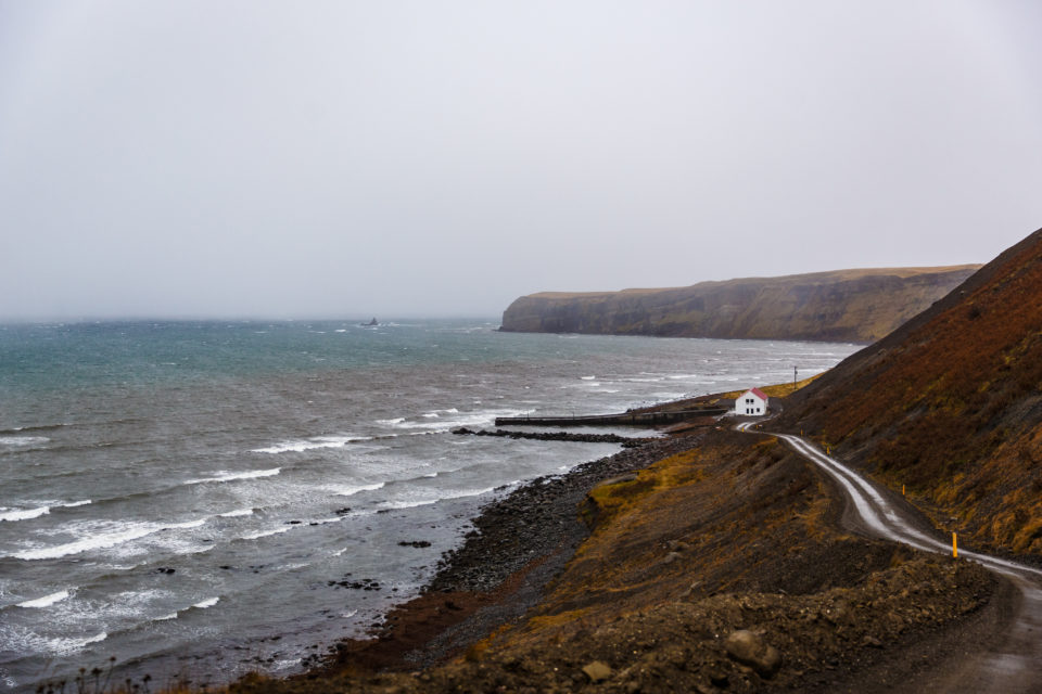
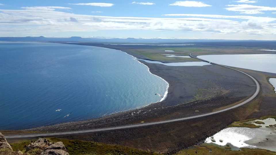
Tjörnes Peninsula
The peninsula just North from Húsavík simply looks as a regular peninsula. Great views, high cliffs, green hills and some lava. But Tjörnes hides in itself some secrets: fossils. The cliffs are made up of layers and the most ancient one dates about 2 millions years. Read more>
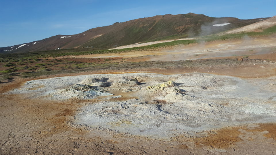
Þeistareykir Geothermal Area
Þeistareykir is Húsavík´s closest active geothermal field. Similar to the Krafla area by Lake Mývatn, Þeistareykir is a geothermal area with a range of unusual geological attributes, including boiling pools of sulfuric acid, volcanic craters, lava fields and table-top mountains. Read more>
Öxafjörður Fjord
The Öxafjörður fjord spans about 30km between Tjörnes peninsula and Melrakkaslétta. In the past millenia the Jökulsá river has brought a lot of sand and sediments into the fjord, creating a flat sandy area. Read more>